
"The Mountains are calling and I must go." -John Muir
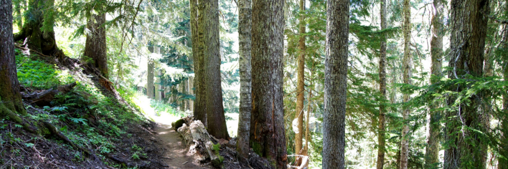
The forests and woodlands surrounding Grass Valley and Nevada City are full of awe-inspiring hiking, biking, and equestrian trails.
Nevada City is nestled at an altitude of 2,477 feet and is a gateway to the Tahoe National Forest. This gold rush era town is ringed by deep green hillsides and is located just minutes from sparkling Sierra Nevada lakes, rivers, and forested trail systems perfect for hiking.
While there are many fantastic hikes to enjoy in the area, the three listed below are daily favorites. They're close enough to town to access easily - while allowing you to get a feel for the flora, fauna, and history of this place without getting lost.
If you or someone in your company are an intrepid explorer and would like to go farther afield, visit the Bear Yuba Land Trust and peruse the many, many possibilities!
HIKES
"I understood at a very early age that in nature, I felt everything I should feel in church but never did. Walking in the woods, I felt in touch with the universe and with the spirit of the universe." - Alice Walker
DEER CREEK TRIBUTE TRAIL (URBAN)
Deer Creek Tribute Trail is a nod to the region's native Nisenan tribe and to the presence of and historic contributions made by Chinese immigrants to the area.
There is a well developed trail along Little Deer Creek in town (a historic route which runs through downtown Nevada City) that connects segments along the canyon of Deer Creek west of town. Travel this fine trail to a beautiful plaza at Stocking Flat on Deer Creek with its new Suspension Bridge across Deer Creek to a forested loop trail.
All of this is linked to a popular footpath of 1.8 miles along the historic Newtown Canal west of town. This is a great trail system with lots of interesting and beautiful options to explore.
Click the button below for more details and to download a map.
HIRSCHMAN TRAIL (NEVADA CITY)
Only a mile from the heart of downtown Nevada City, you'll find this trail system. It will get you quickly out into nature.
The highlight of this hike is lovely Hirschman’s Pond, named after the Hirschman brothers, who were pioneer miners and merchants of the area.
The eastern 0.4-mile portion of the trail is constructed to ADA standards, providing barrier-free access to Hirschman’s Pond. This section of trail features a 40-foot long trestle that was built to replicate the railroad and flume construction techniques of the late 1800’s.
West of the pond, the trail narrows and meanders through oak woodlands, pines, and grasslands for an additional 2 miles.
Click the button below for more details and to download a map.
HARDROCK TRAIL (GRASS VALLEY)
The popular Hardrock Trail traverses the historic heart of Empire Mine State Historic Park.
The trails at Empire Mine, combined with the adjoining Union Hill trails area on the north and the Osborne Hill trails on the south, gives visitors access to the entire 856 acre park.
We suggest approaching this hike from the Penn Valley Gate and accessing the loop that starts with a long level stretch going south, crosses Little Wolf Creek, then turns east and begins a long and gentle counterclockwise climb to its highest point alongside the mine yard near the Visitor Center. Return to Penn Gate via the Empire Street trail starting at the Visitor Center.
It’s level or easy downhill all the way and takes approximately 1 hour.
Click the button below for more details and to download a map.